Your cart
There are no more items in your cart
- Support
- MSD Card SD card
- Main brand compatibility
- Garmin
753759290429
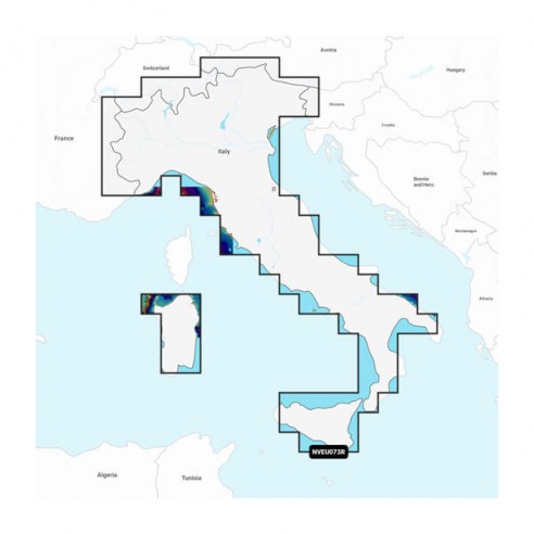
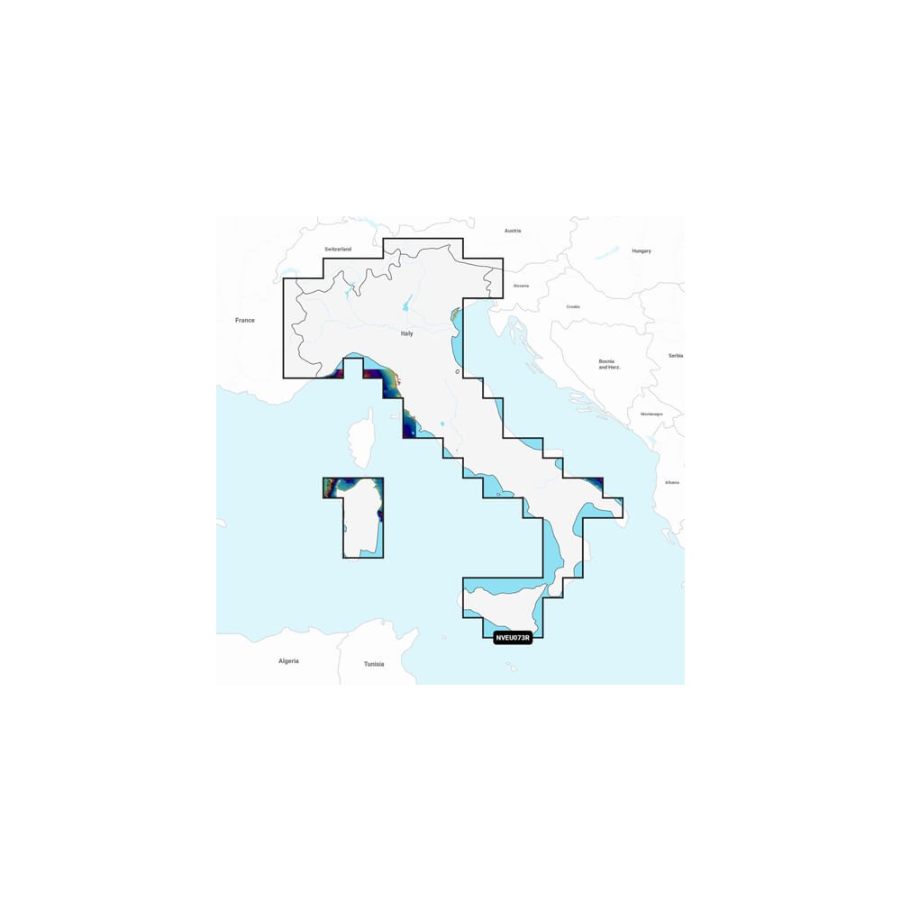
Plan every route with precision and style with Garmin Navionics Vision ™ premium cartography, the most advanced and up-to-date available for your compatible Garmin chartplotter. Perfect for navigation on the open ocean or along the coast, it offers highly detailed maps, high-resolution Relief Shading, 3D views, satellite imagery and innovative Auto Guidance ™¹ technology. All with access to daily updates via the ActiveCaptain® app.
Purchased together
Alternative products
Elevate your navigation experience with Garmin Navionics Vision ™, the most advanced cartography available for compatible Garmin chartplotters. Designed to provide a realistic and detailed depiction of the marine environment, it includes exclusive features for planning every route safely and with a complete view, above and below the waterline:
Integrated Garmin and Navionics® content, with updated color palettes and intuitive graphical style for exceptional chart detail.
Instant access to daily chart updates via ActiveCaptain® app.
Auto Guidance ™ technology for dock-to-dock routes based on depth, vertical footprint and actual navigation data.
High-resolutionRelief Sh ading to clearly visualize the seafloor through a combination of colors and shadows.
High-resolution satellite images superimposed on maps for a realistic view of coastlines and harbors.
Aerial photos of harbors, bridges, piers and landmarks, useful for immediate visual orientation.
Unique 3D visualizations such as MarinerEye and FishEye, for exploring above and below sea level at an immersive glance.
Depth range shading, with up to 10 selectable colors to highlight desired areas.
Bathymetric lines every 50 cm, ideal for fishing and precise bottom reading.
Shading of shallow water, customizable to avoid shallow areas while boating.
Points of interest, reviews and suggestions from the ActiveCaptain® Community, based on the direct experience of boaters.
Worldwide coverage available, in microSD™ format or digital download (areas sold separately).
Includes 1 year of free updates, then renewable with annual subscription.
New Garmin Navionics ™ and Navionics Vision ™ chartplots offer a superior level of coverage, clarity and detail for both inland and coastal waters. Perfect for your compatible Garmin chartplotter, they give you accurate and up-to-date navigation. If your device does not yet support the Garmin Navionics format, you can continue to use BlueChart® g3 charts until you decide to upgrade. Do you use a chartplotter from another brand? No problem: you can also find compatible Navionics charts at HiNelson.
| Chartplotter Model | Compatible cartography |
|---|---|
| ECHOMAP (NOT CHIRP) | BlueChart |
| ECHOMAP CHIRP (4/5/7/9) | BlueChart |
| ECHOMAP PLUS (4/6/7/9) | BlueChart |
| ECHOMAP UHD (6) | BlueChart |
| ECHOMAP UHD (7/9) | BlueChart, Garmin Navionics |
| ECHOMAP UHD2 (5/7) | BlueChart, Garmin Navionics |
| ECHOMAP UHD2 (6/7/9) | BlueChart, Garmin Navionics |
| ECHOMAP ULTRA (10/12) | BlueChart, Garmin Navionics |
| ECHOMAP ULTRA 2 (10/12) | BlueChart, Garmin Navionics |
| GPSMAP 4000/5000/6000/7000 | BlueChart |
| GPSMAP 7x1/5x7 | BlueChart |
| GPSMAP 8x0/10x0 | BlueChart |
| GPSMAP 7x2/9x2 | BlueChart |
| GPSMAP 10x2/12x2 | BlueChart, Garmin Navionics |
| GPSMAP 12x2 TOUCH | BlueChart, Garmin Navionics |
| GPSMAP A12 | BlueChart, Garmin Navionics |
| GPSMAP A7 | BlueChart, Garmin Navionics |
| GPSMAP 7X21/9X21/12X2 PLUS | BlueChart, Garmin Navionics |
| GPSMAP 7x3/9x3/12x3/16x3 | BlueChart, Garmin Navionics |
| GPSMAP 7400/7600 | BlueChart |
| GPSMAP 8000 | BlueChart |
| GPSMAP 8400/8600 | BlueChart, Garmin Navionics |
| GPSMAP 8500 BB | BlueChart |
| GPSMAP 8700 BB | BlueChart, Garmin Navionics |
| GPSMAP 9000 | BlueChart, Garmin Navionics |
| GPSMAP 9500 BB | BlueChart, Garmin Navionics |
Popular products in recent days
Don't miss our bestsellers
